Selected Projects
These projects show how I apply geospatial analysis, remote sensing, and environmental modelling to real-world problems, from ecosystem monitoring to land use change and spatial decision support.
Projects are grouped across core focus areas including ecosystem monitoring , environmental systems analysis, and GeoAI-driven workflows.
Coastal Wetland Monitoring for Sustainable Development
A 30-year geospatial analysis revealing structured wetland loss and anthropogenic transformation across two Ramsar coastal catchments in Ghana.
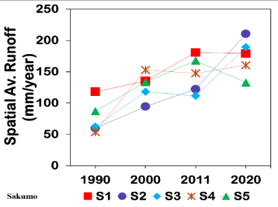
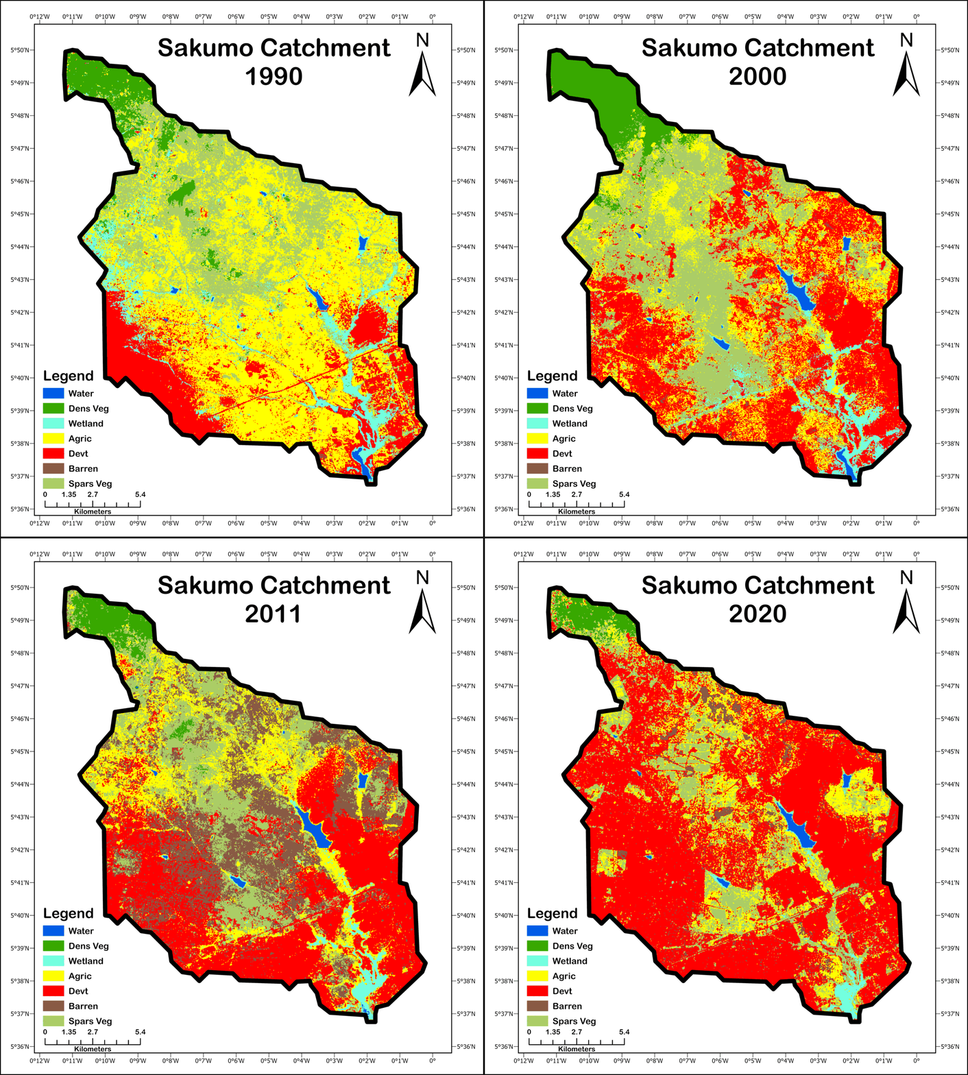
Multi-Temporal Land Use Change and Runoff Modelling in the Sakumo Catchment
Integrated geospatial analysis of 30 years of satellite data to assess land-use change, runoff dynamics, and non-point source pollution hotspots within a Ramsar-designated wetland catchment.
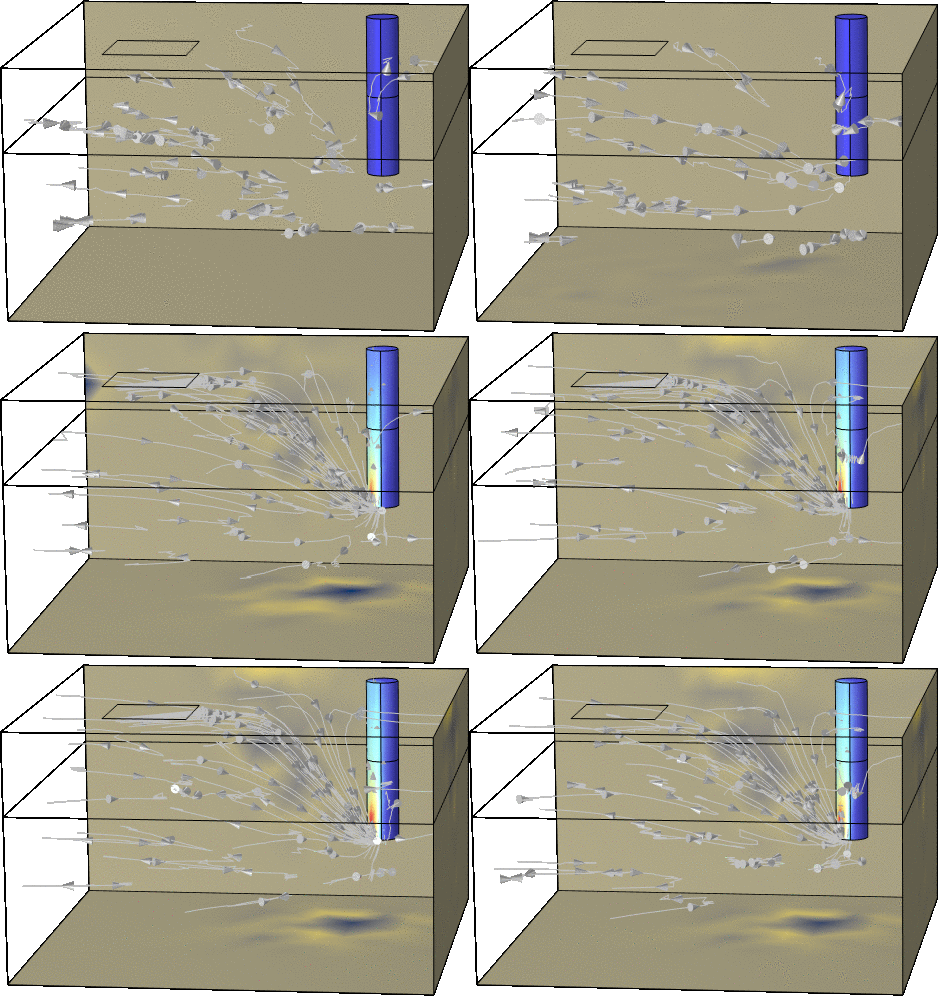
Subsurface Flow and Transport Modelling for Groundwater Risk Analysis
Finite element simulation of groundwater flow and contaminant transport in layered aquifer systems to evaluate vulnerability under pumping stress.
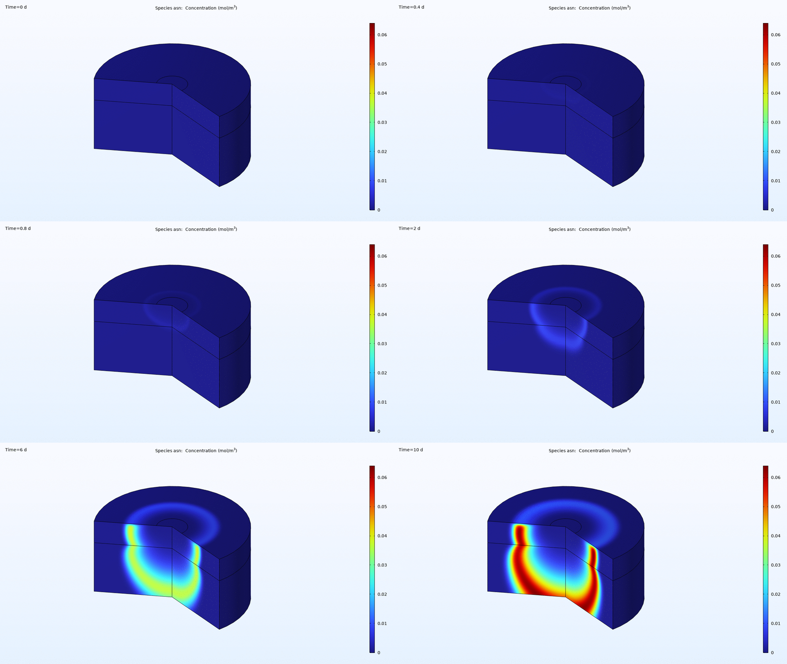
Reactive Transport Modelling of Pesticide Fate in Variably Saturated Soil
Coupled kinetic–hydraulic simulation of pesticide degradation and transport used to evaluate groundwater contamination risk under infiltration-driven conditions.
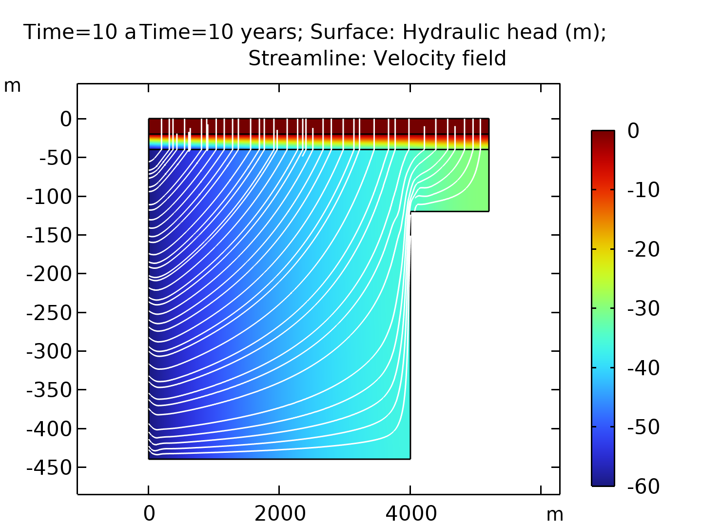
Terzaghi Consolidation Modelling for Aquifer Compaction and Subsidence Analysis
Finite element implementation of Terzaghi consolidation theory in COMSOL to simulate pore pressure dissipation and vertical compaction in layered aquifer systems under groundwater withdrawal.